
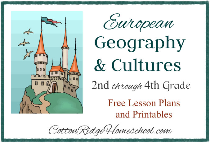
European Geography & Cultures ~ Free Lesson Plans & Printables
Introduction
I hope you had a wonderful summer! I’m excited to share what my homeschool coop class will be learning this year about European Geography and Cultures. Links to detailed blog posts for each class are below. Each post includes a Lesson Plan, Printables, Project Instructions, Resource List, and more. Ideas for additional art and craft projects will also be included. Each lesson plan can be split into two – four lessons.
Would you and your students like to have some “traveling” to Europe this year? Following are lists of suggested books and resources, as well as a suggested class structure which you can adapt to your own needs. Each lesson plan will also include additional materials and resources needed specifically for that week.
Disclosure: I was not compensated for this post. I am an affiliate of Amazon, and will receive a small commission if a link on this page is used to make a purchase.
You can download the Summary, Class Structure, Weeks 1 & 2 Lesson Plans, and Checklists as a PDF file.
Click on the thumbnail below and open the PDF file in Adobe Reader to read and print. If you open in a browser window, the text may be garbled. You may share this online and use the image above without permission, but please have all links point to this blog post, not to the PDF file. Thanks!
Weekly Lesson Schedule
The blog post for each week’s lesson plan will be linked below as they are posted. These have been written and scheduled to post over the next four weeks.
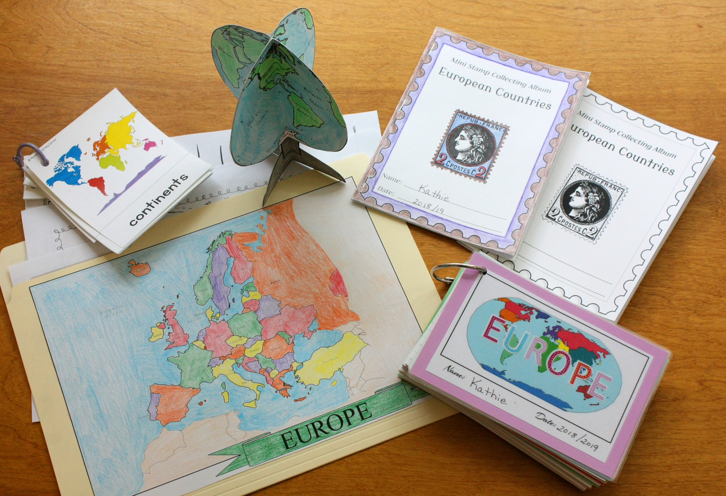
General Instructions and Printables: Geography Card File
General Instructions and Printables: Map Folders and Stamp Collecting Albums
Lesson 1: World
Lesson 2: Europe
Lesson 3: The British Isles: The United Kingdom (England, Scotland, Wales, Northern Ireland) and Ireland
Lesson 4: Nordic Countries (Iceland, Finland, and Scandinavia: Norway, Sweden and Denmark)
Lesson 5: Germany
Lesson 6: Alpine States (Switzerland, Austria, Lichtenstein, and Slovenia)
Lesson 7: The Low Countries (The Netherlands, Belgium, and Luxembourg)
Lesson 8: Central Europe (Poland, Czech Republic, Slovakia, and Hungary)
Lesson 9: Ukraine, Moldova, and Romania
Lesson 10: European Russia
Lesson 11: Italy, Greece, and Bulgaria
Lesson 12: Spain and Portugal
Bonus Lesson: France
Suggested Class Structure
Note: This plan calls for two lessons per Country or Region of Europe at coop, plus two lessons at home. This structure starts with the Week 3 Lesson Plan – The British Isles. Modify the structure to fit your needs.
Lesson A – Coop
- Pass out Map Folders and Mini Stamp Collecting Albums, applicable stamps and stamp hinges.
- Read Galloping the Globe if applicable.
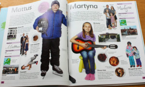
- Read Children Just Like Me if applicable.
- Have students take turns reading A True Book or A to Z or similar book about the country.
- Read/review the applicable pages in the DK Where On Earth? Atlas and the DK Children’s World Atlas. Color in the country of the week on folder map.
- Card Files: Work on Flag, Map, Country Information, and Category cards while listening to an Around the World Stories audio story. Have cards made that they can copy.
- Students may work on additional worksheets (coloring pages, etc.) after they are done with the card files while listening to the audio story. They may also color in the oceans on their folder map.
Lesson A – Home (Art, Music, or Family Consumer Sciences)
- Listen to music CDs from composers of the country.
- Choose one project to do or meal to make while listening to music.
- Listen to Around the World Stories.
Lesson B – Coop
Art or Cooking Class
Lesson B – Home (Art, Music, or Family Consumer Sciences)
- Choose one project or meal to make.
- Read a biography or another short book about the country.
General Resources Needed
- Index Cards (I recommend the 4″ x 6″ size)
- Colored Pencils
- Stapler
- White Glue, Glue Sticks
- Scissors
- Computer with Black and White Printer
- Printer Paper
- Card Stock Paper for printer
- Laminator and laminating sheets (optional)
- File Folders
- European Postage Stamps
- Geography Card File click here for blog post with instructions and printables)
Book List
Be sure to check your local library to see if they have some of these books! The books about the countries were based on my library’s availability. Feel free to substitute if your library has different choices.
* See below for more information.
Books about Countries:
- England (True Books: Countries)
- Country Explorers: Norway
- Germany (A to Z)
- Look What Came From Austria
- Look What Came From the Netherlands
- Looking at Poland
- The Romania Fact and Picture Book: Fun Facts For Kids About Romania **
- Russia (A to Z)
- Italy (A to Z)
- Greece (A to Z) or Greece (True Books: Countries)
- Spain: A Benjamin Blog
- France (A to Z)
** This is the only book I could find about this region. It is a little below the age group I am teaching, but it has great pictures and some basic facts.
Additional Books You May Find Helpful
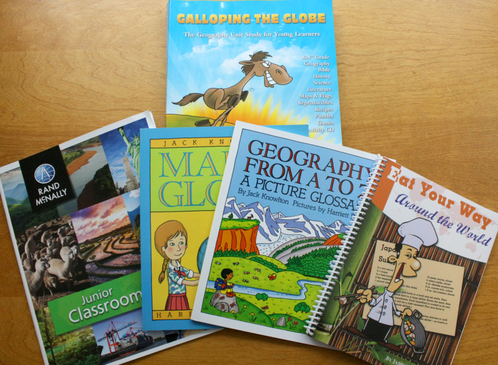
- Galloping the Globe – this unit study includes a CD with lots of printables. This book helped me get started creating my lesson plans – if you would like more book and activity suggestions for each country, I would recommend this book.
- Rand McNally Junior Classroom Atlas – this is a nice size atlas for reference when you are reading on the couch.
- Eat Your Way Around the World – this cookbook has simple recipes from around the globe, along with interesting facts about each country.
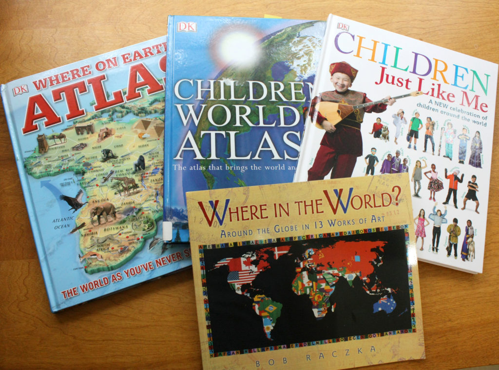
- Where in the World? Around the Globe in 13 Works of Art – neat book featuring large pictures and interesting information.
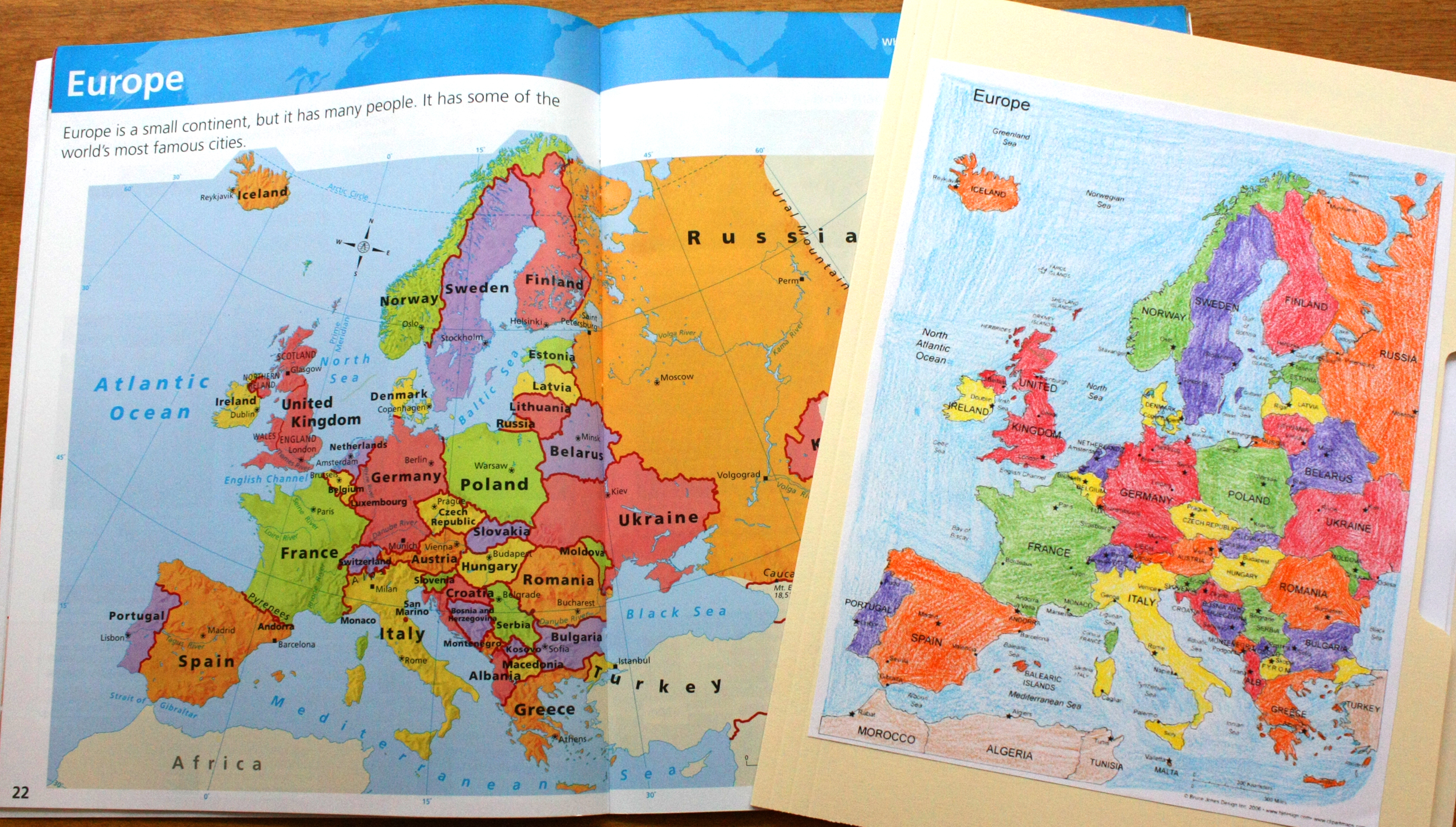
About the Atlases
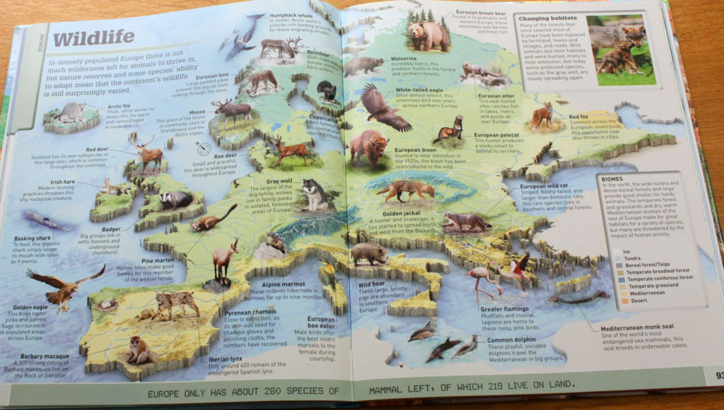
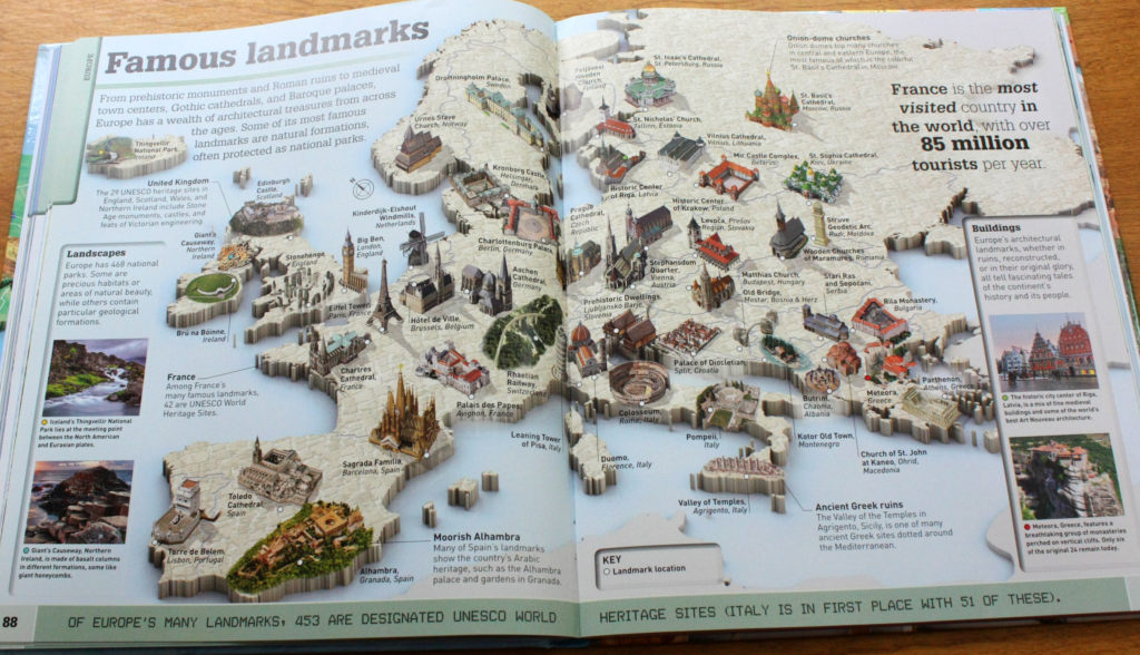
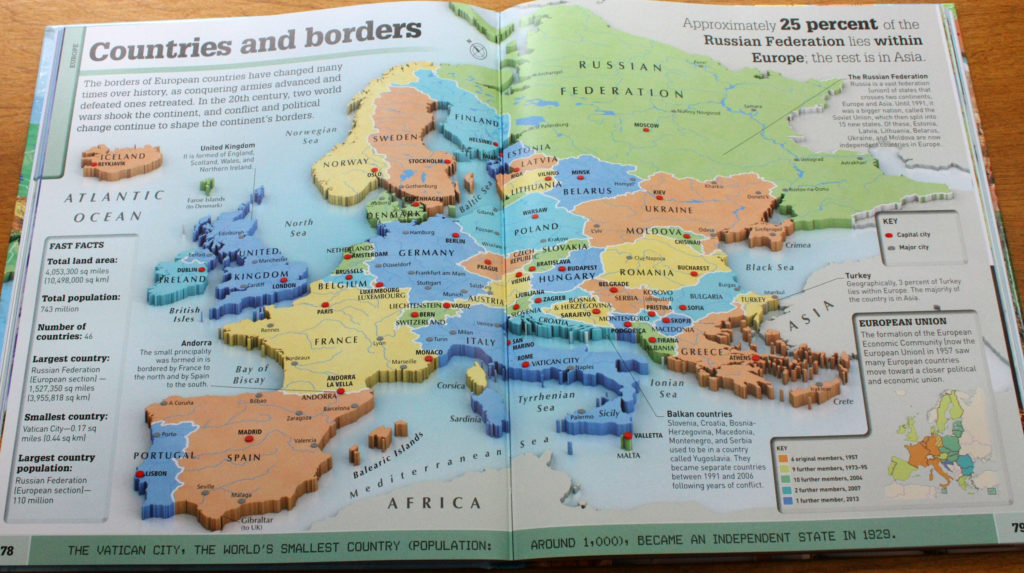
I’m recommending two different large children’s atlases because they present geographical information in two different ways. The DK Where On Earth? Atlas shows the information by continent – here are a few examples:
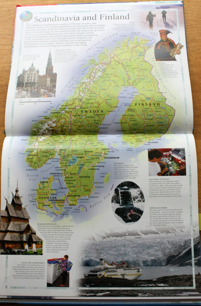
The DK Children’s World Atlas shows the information by region – here is an example:
Please comment below with your questions and suggestions – I will respond as soon as I can! Thank you for visiting Cotton Ridge Homeschool!
Copyright 2018 Kathryn Depew
Disclosure: I was not compensated for this post. I am an affiliate of Amazon, and will receive a small commission if a link on this page is used to make a purchase.
Leave a Reply